Backpacking in North Cascades.... the most scenic mountain range
North Cascades: stunning views of oceans of mountains and scenic valleys plastered with waterfalls and wild flowers
The Cascades is a mountain range that stretches from British Columbia in Canada to Northern California, passing thorugh Washington and Oregon. The section above Mount Rainier in Washington is the North Cascades National Park. This area is packed with mountains, literally an ocean of mountains!
We backpaked a section of the North Cascades which included Cascade Pass, Sahale Arm, Stehekin Valley and Horseshoe basin. This is a very popular area with a very well planned trail system. Permits are required for the limited campspots all along this region and it is quite easy to get the permits if you are flexible with your plans.
This trip was completed end of August 2020. Here’s a map of our walk:
Since our permits started with a backpacking site near the trailhead, we took the opporunity to do a day hike to Maple Pass on the first day and then start our backpacking.
Day 1: Maple Pass. This is a relatively easy day hike, close to Winthrop. It is a 7.2 miles loop that gains (and drops) 2000 feet in elevation with breath-taking 360 degree views of Cascades at Maple Pass. You pass Rainy Lake and Lake Ann if you do the Maple pass loop, and this is arguably one of the best day hikes in Washington, if you compare effort vs reward.
That night we camped at Johannesburg, less than half mile from the trailhead to Cascade Pass.
Distance: 7.2 miles, +2000 feet, -2000 feet
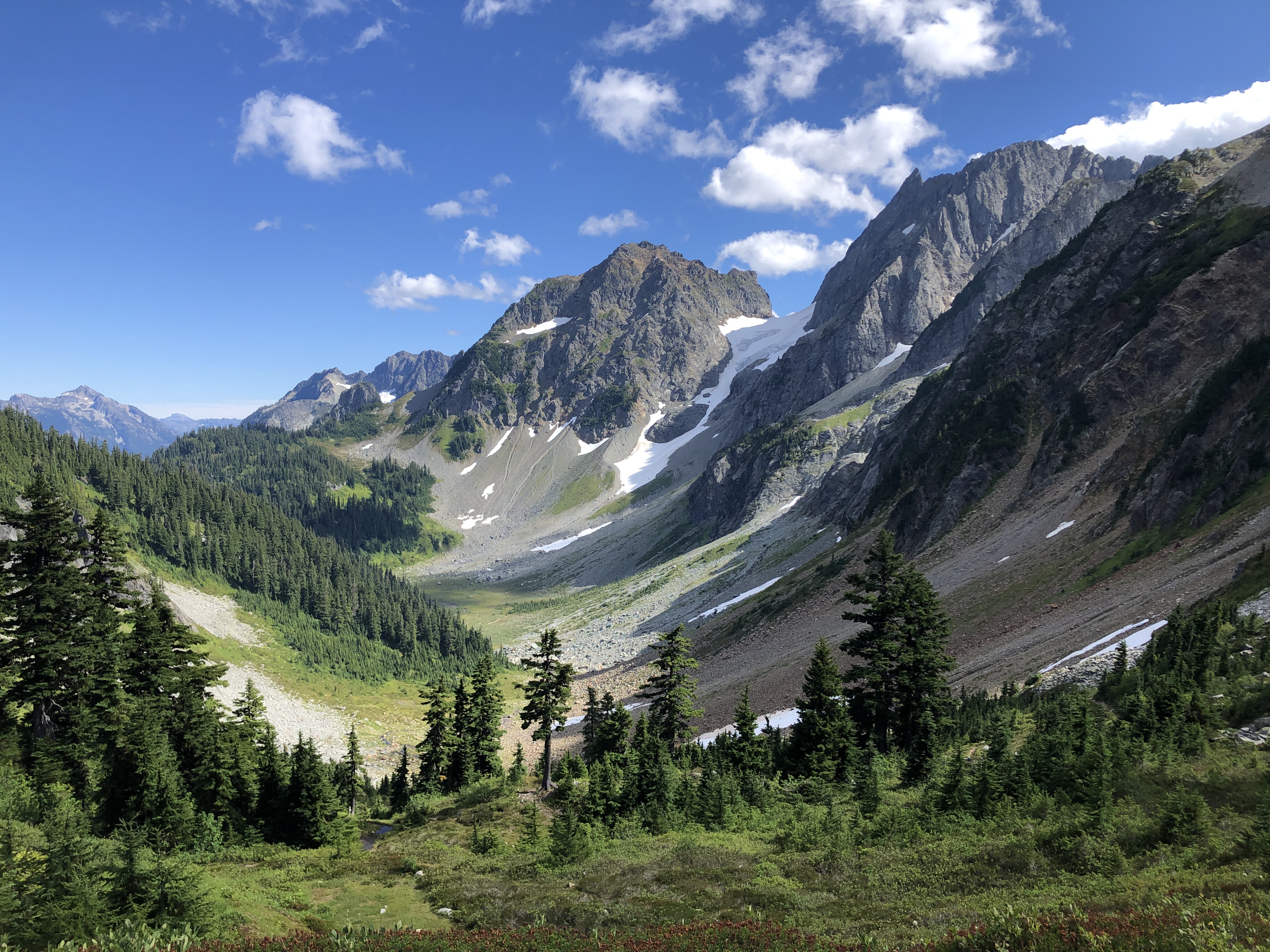
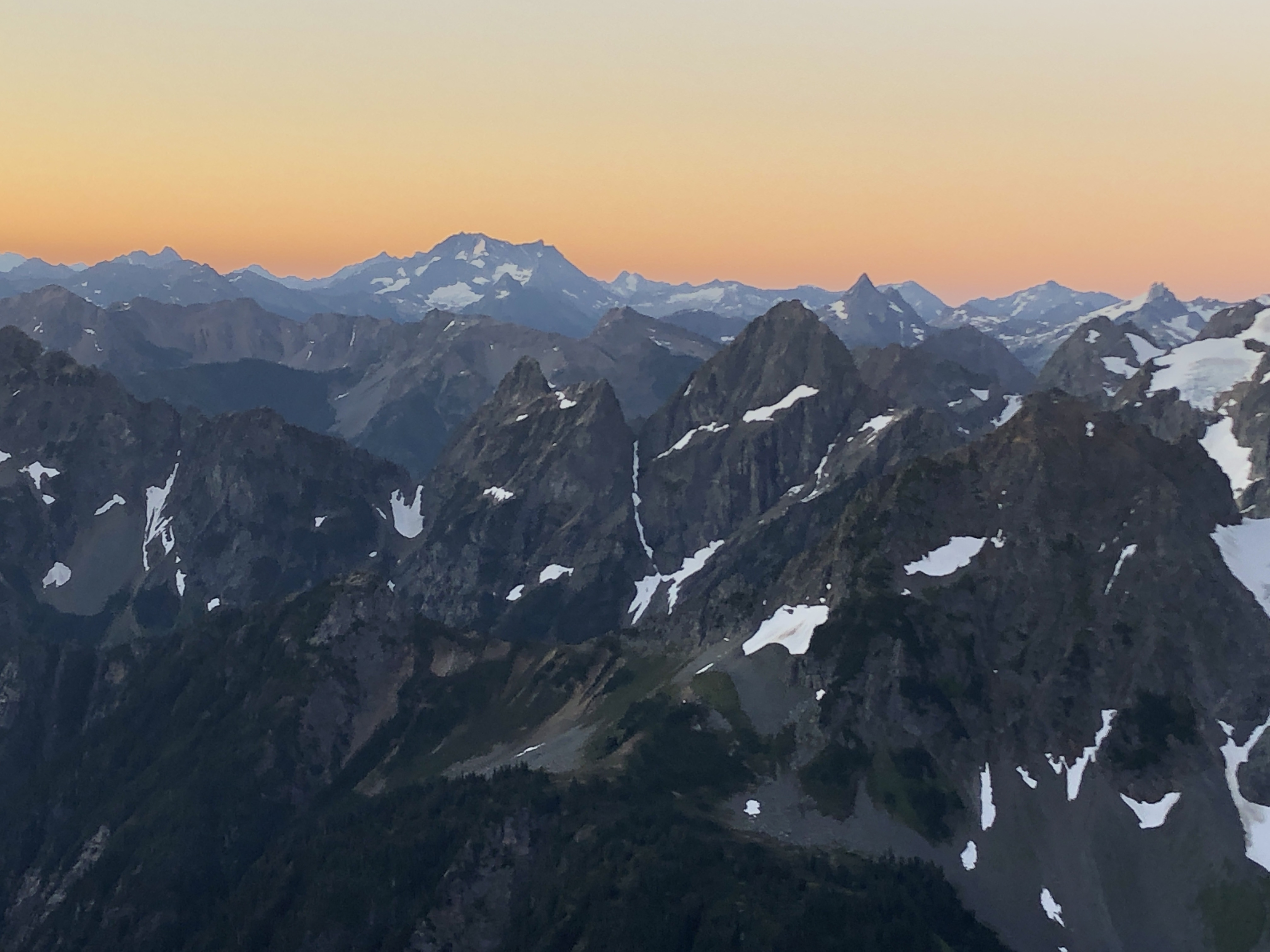
Day 2: From the Cascade Pass trailhead, the trail climbs up 1700 feet over 3.7 miles to reach Cascade Pass. The pass provides a beautiful view of the valley over which we came and the long and picturesque Stehekin valley ahead of us. It can get quite windy here, just as any mountain pass. From Cascade pass, the trail splits, one headed to Sahale Arm and the other to Stehekin. We took the trail to Sahale, since we were camping at Sahale Arm. This trail is very steep, climing 2300 feet over 2.7 miles. There was one especially steep section where we climbed 1000 feet in half a mile!
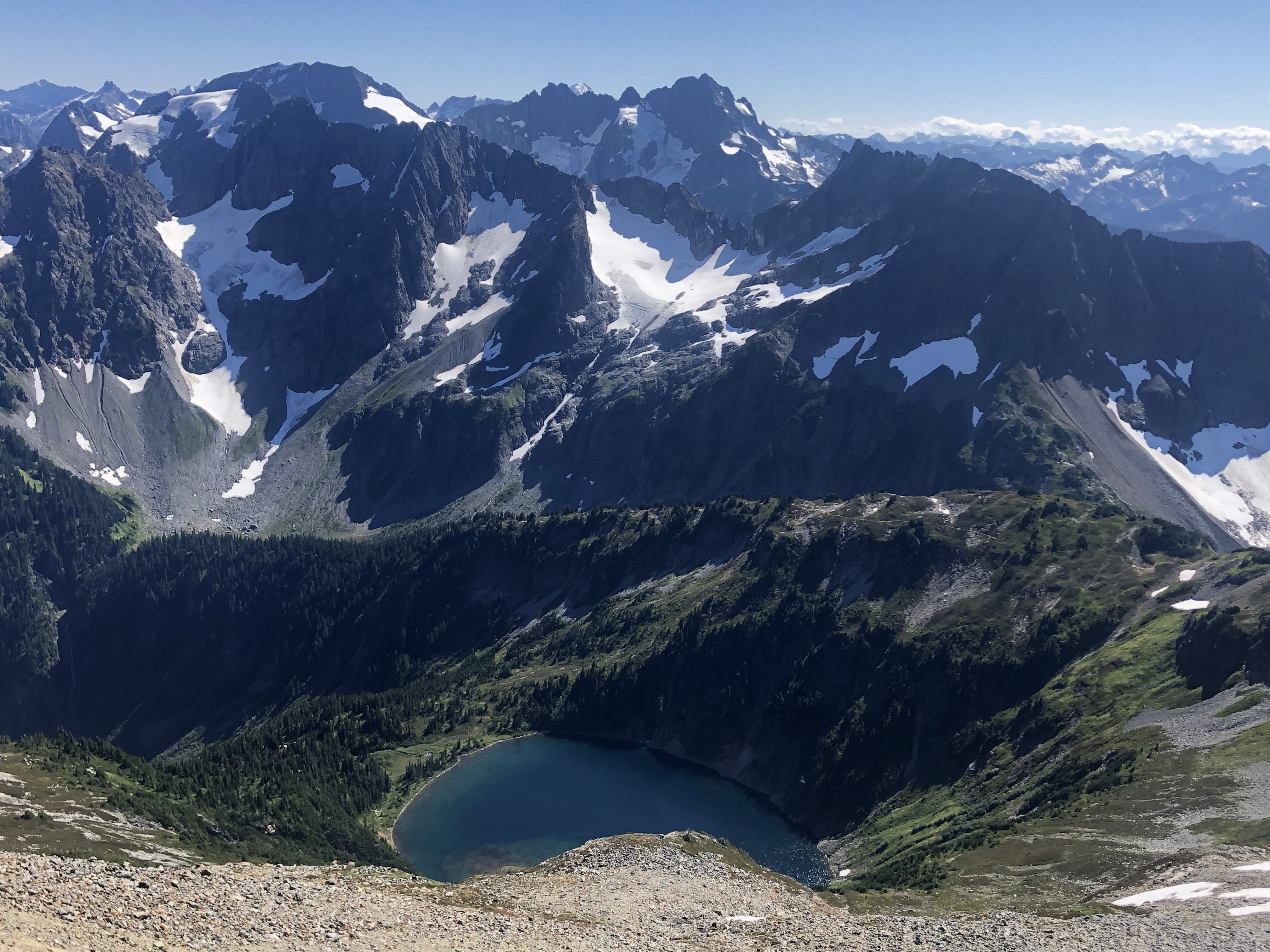
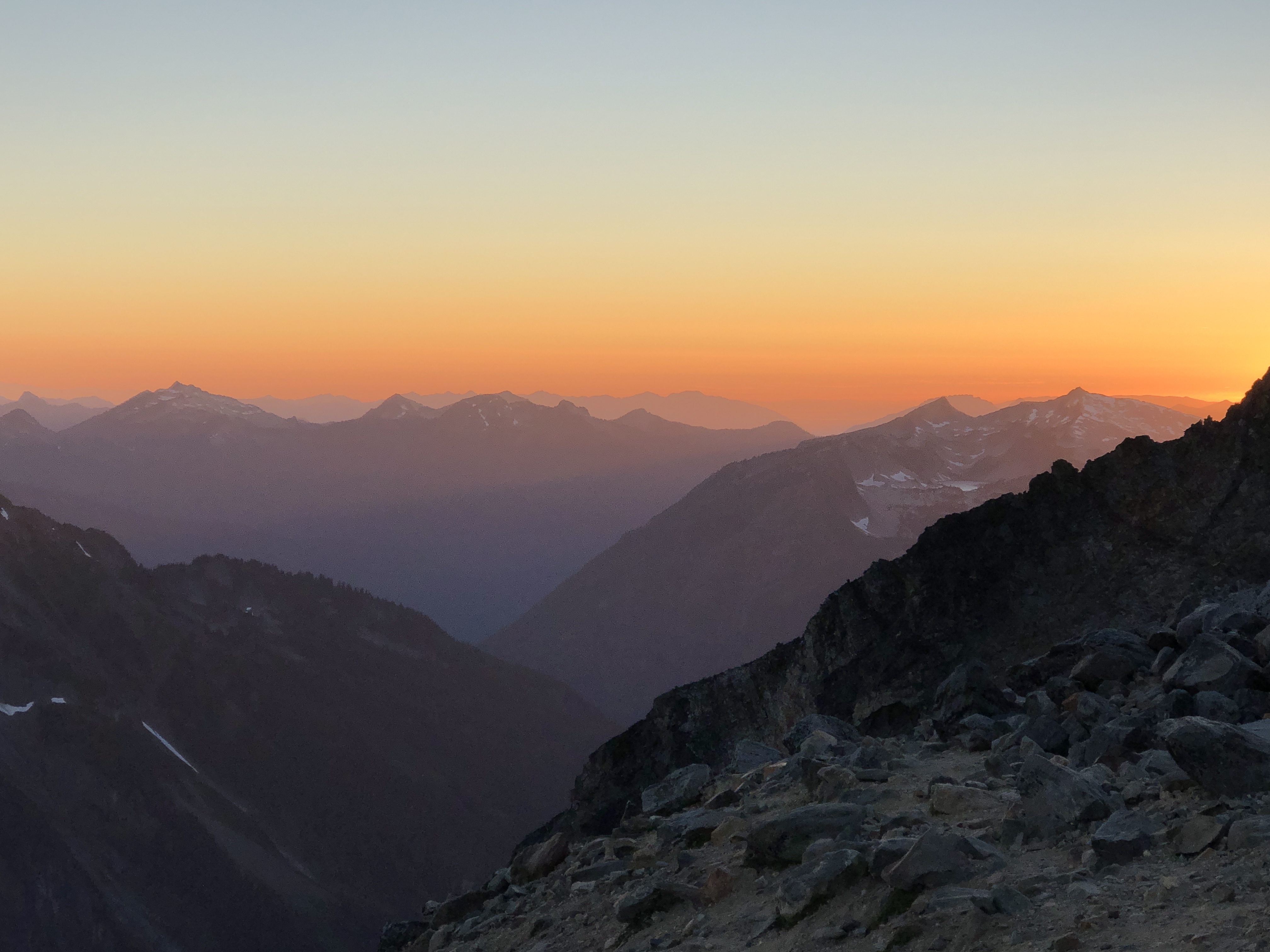
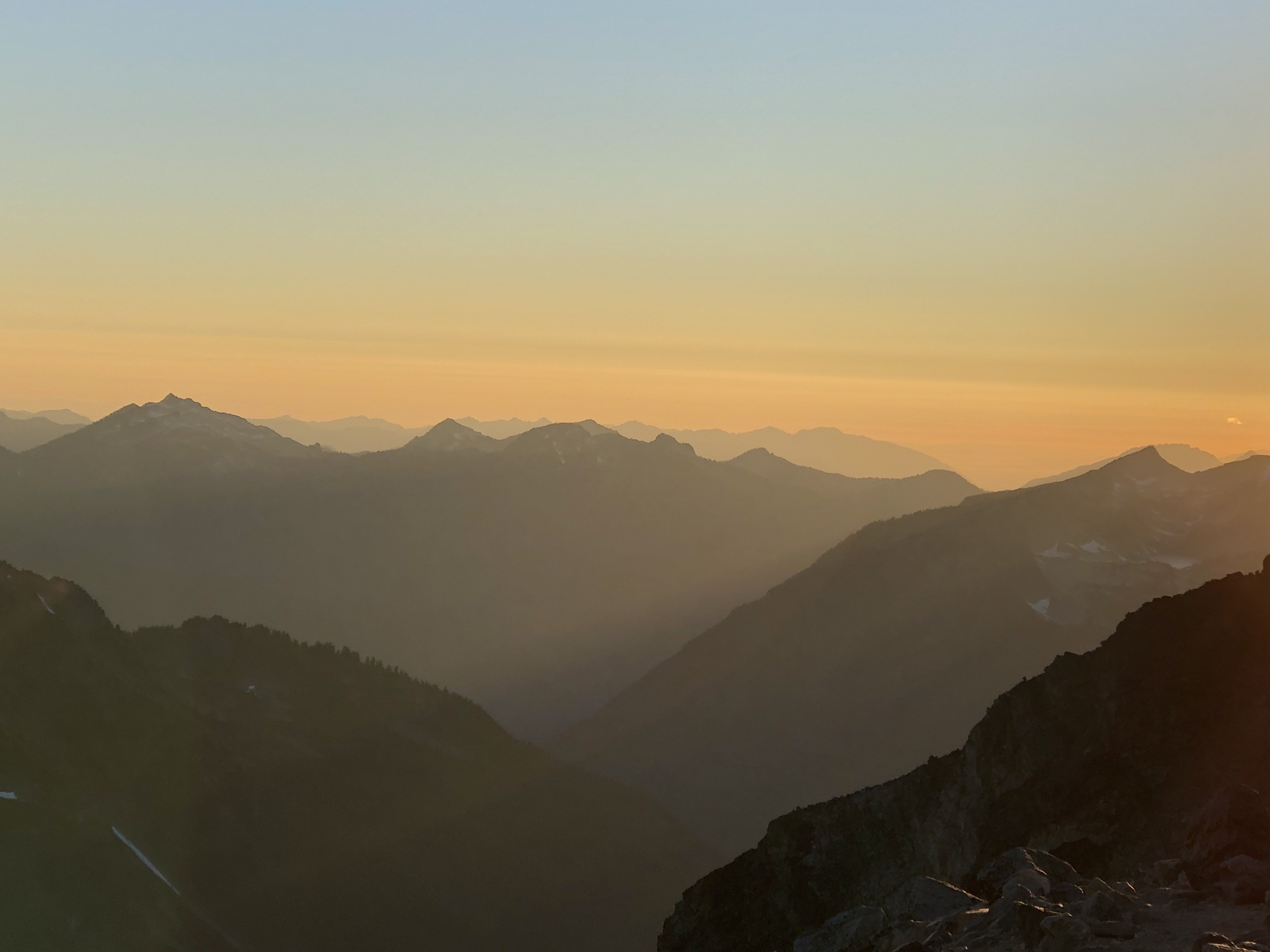
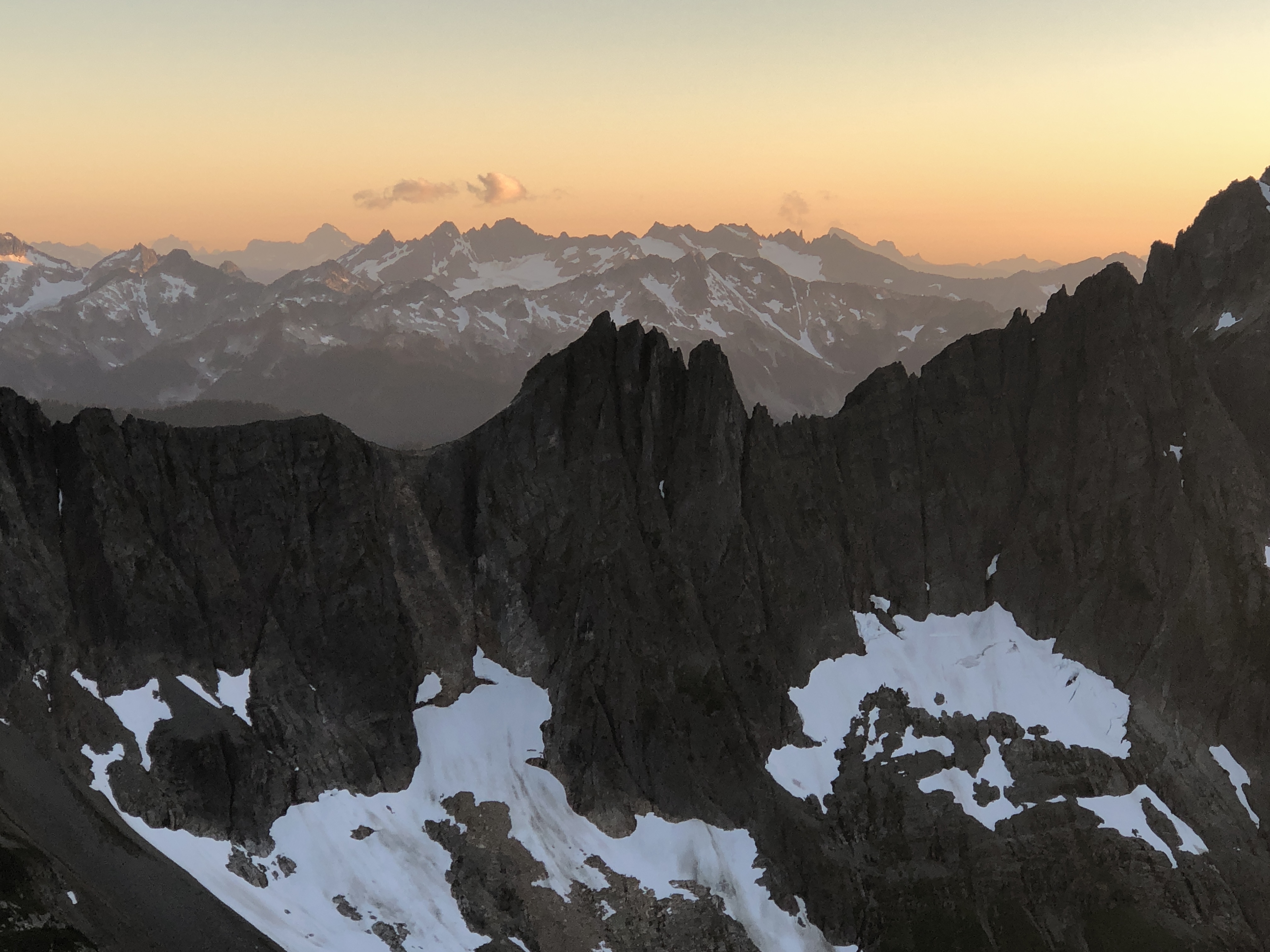
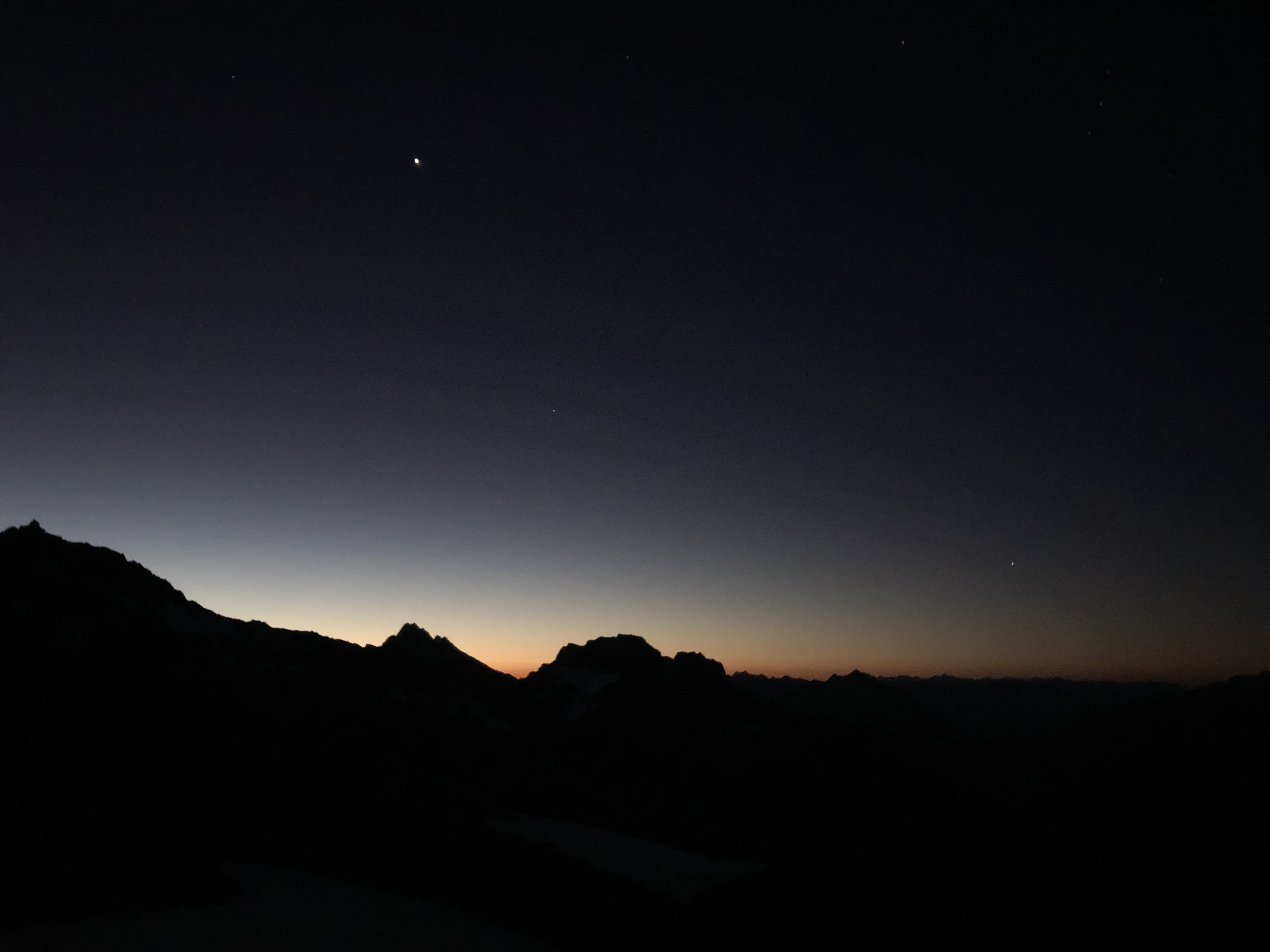
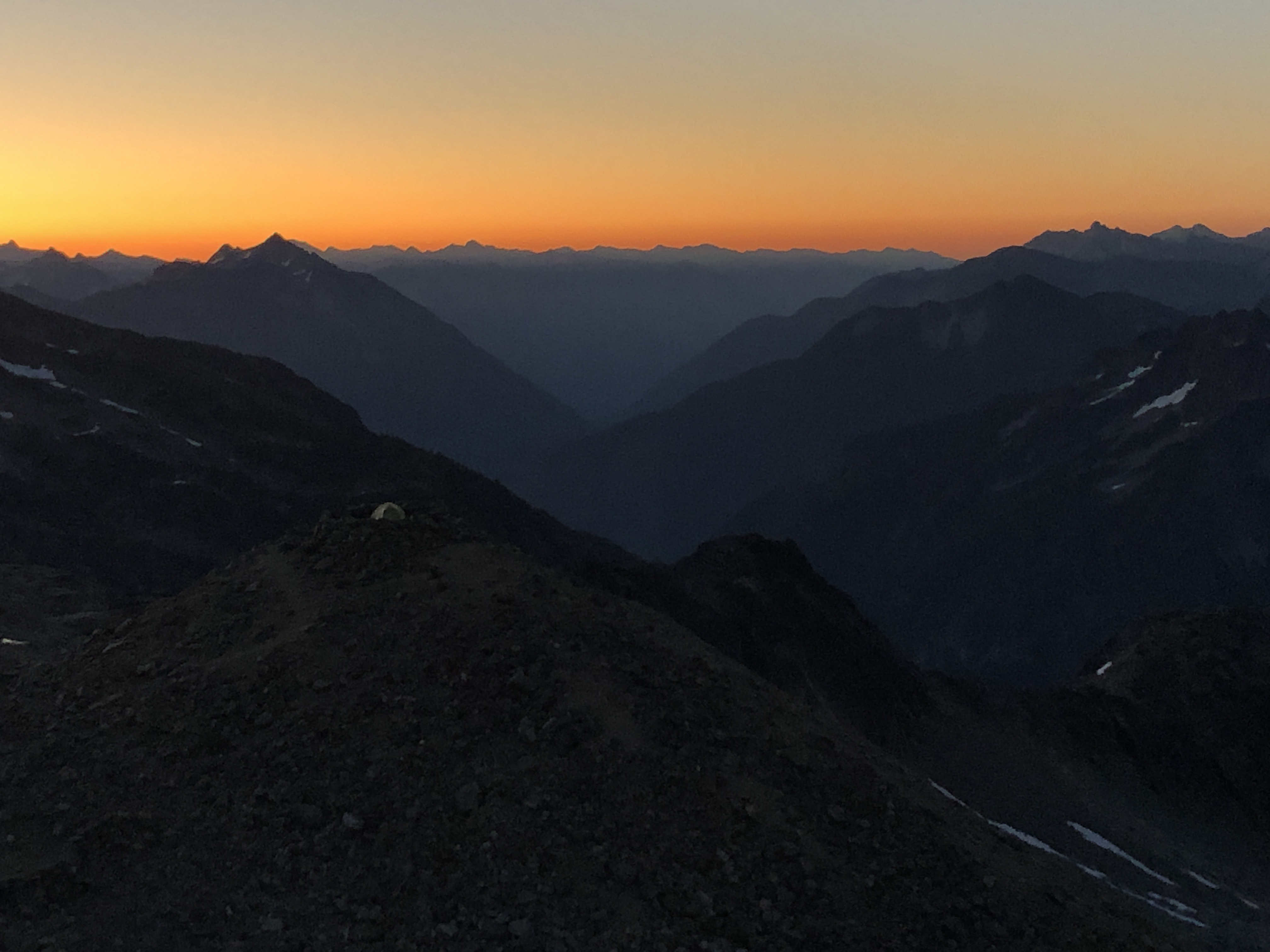
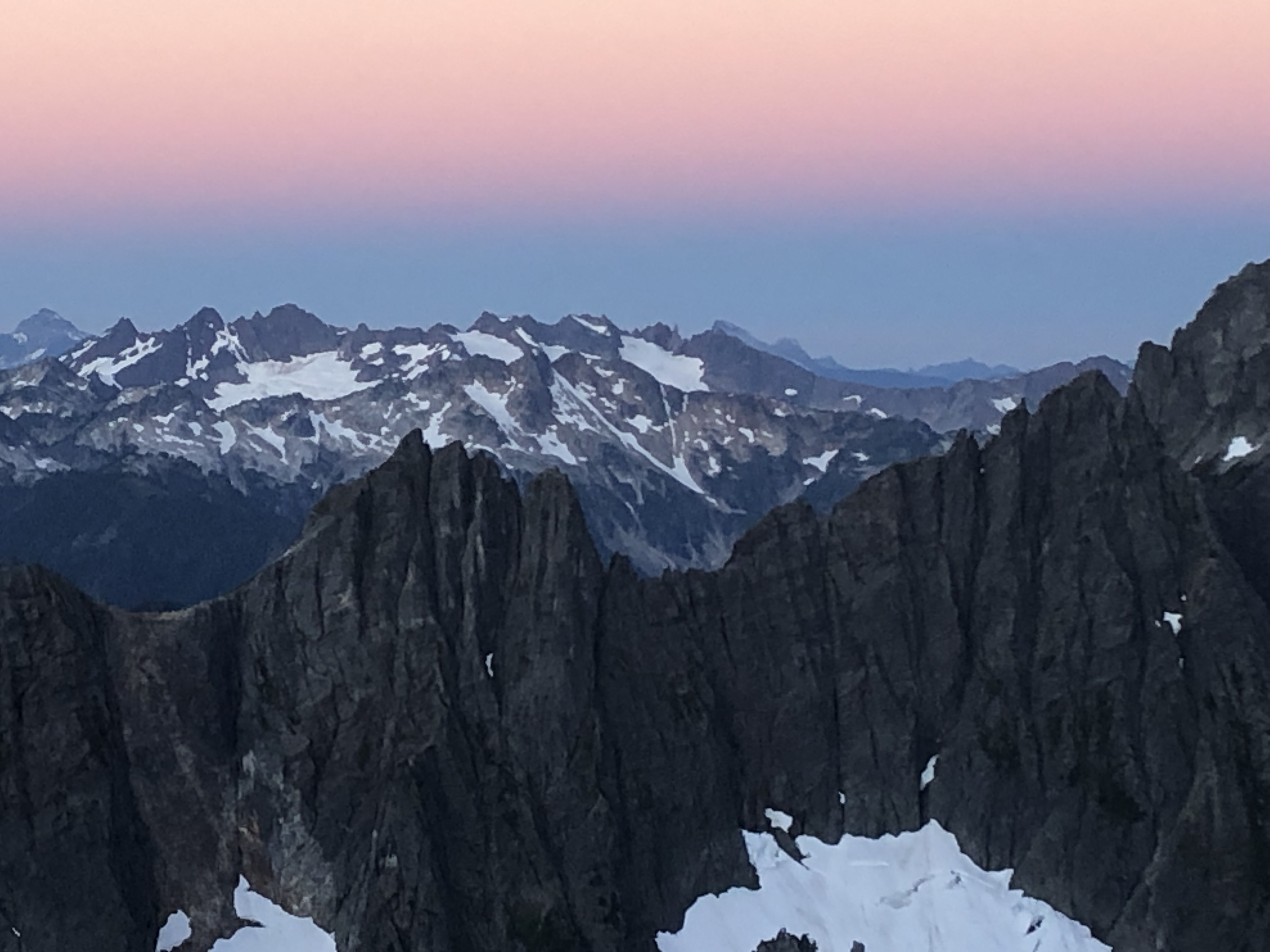
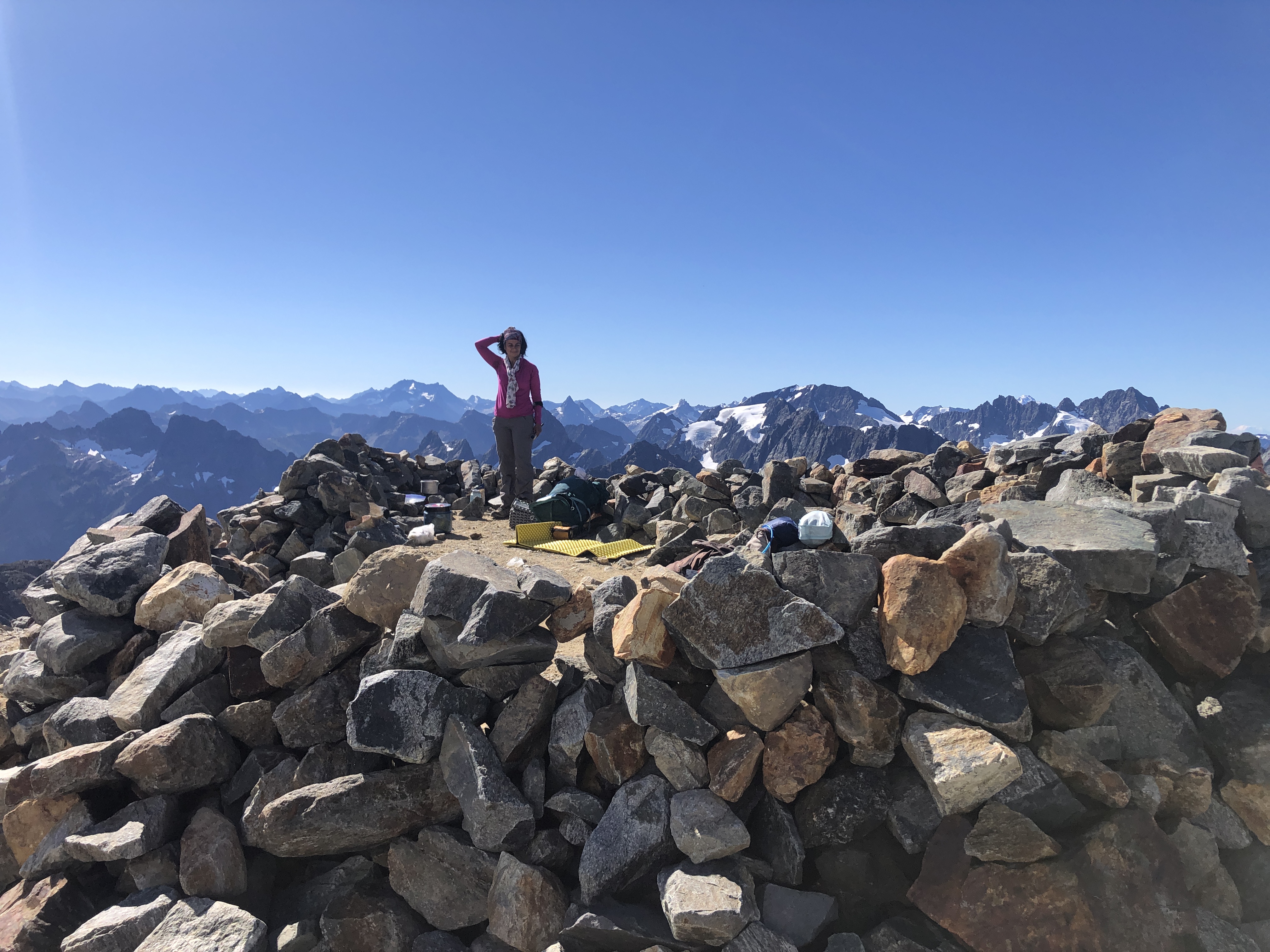
Camping at Sahale Arm is simply spectacular. Each campsite looks like a fortress on top of the mountain. You camp at 7600 feet, and can see the tops of all the Cascade mountains around you for a 180+ degree view. You feel as if you are in the middle of an ocean of mountains. While this view is there all day long for you to enjoy provided the weather is clear, sunset and sunrises are simply magical.
It is a good idea to head out early and reach Sahale Arm well before sunset so you can setup camp and relax in the environment. The first time we did this hike in 2012, we started late in the afternoon and did not reach the camp till after sunset. Doing the last part of the hike in darkness with headlights was simply a nightmare.
Distance: 6.4 miles, +4000 feet, -100 feet
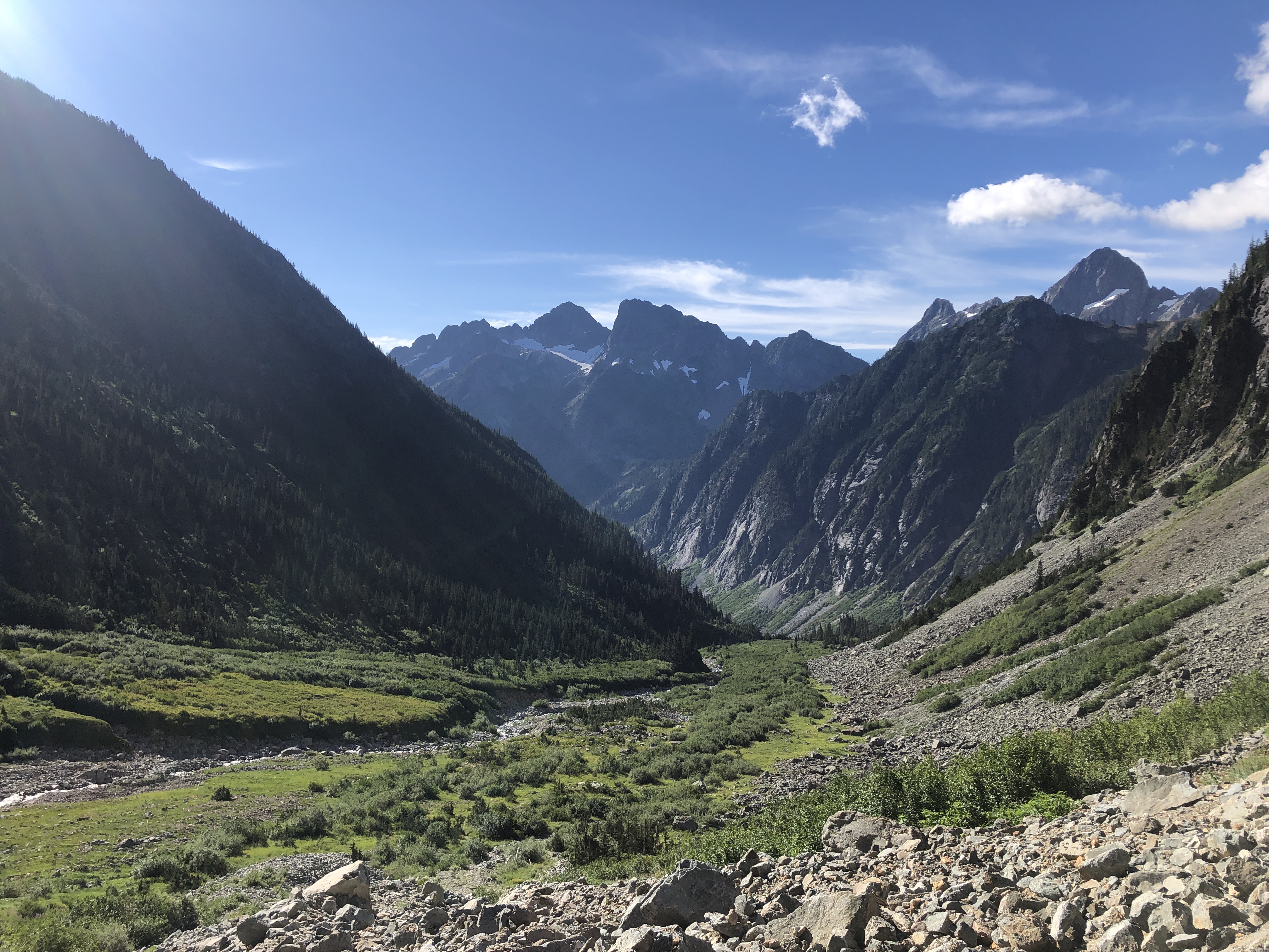
Day 3: From Sahale Arm, we headed back to Cascade Pass. Going down with a pack is harder than going up, since you have to be even more careful on the slippery scree on the steep inclines. From Cascade Pass, we headed down the Stehekin valley to camp at Basin Creek. This part of the trail drops gradually over several switchbacks. Basin Creek campground has just 3 campsites, and it is a beautful camping spot. There is a creek next to the campground called Basin Creek. It seemed more like a waterfall than a creek and it was wonderful to hear the thundering water right next to the campsites. There are rocks to sit by the creek and even take a quick dip if you can tolerate the freezing water.
Distance: 7.4 miles, +200 feet, -4400 feet
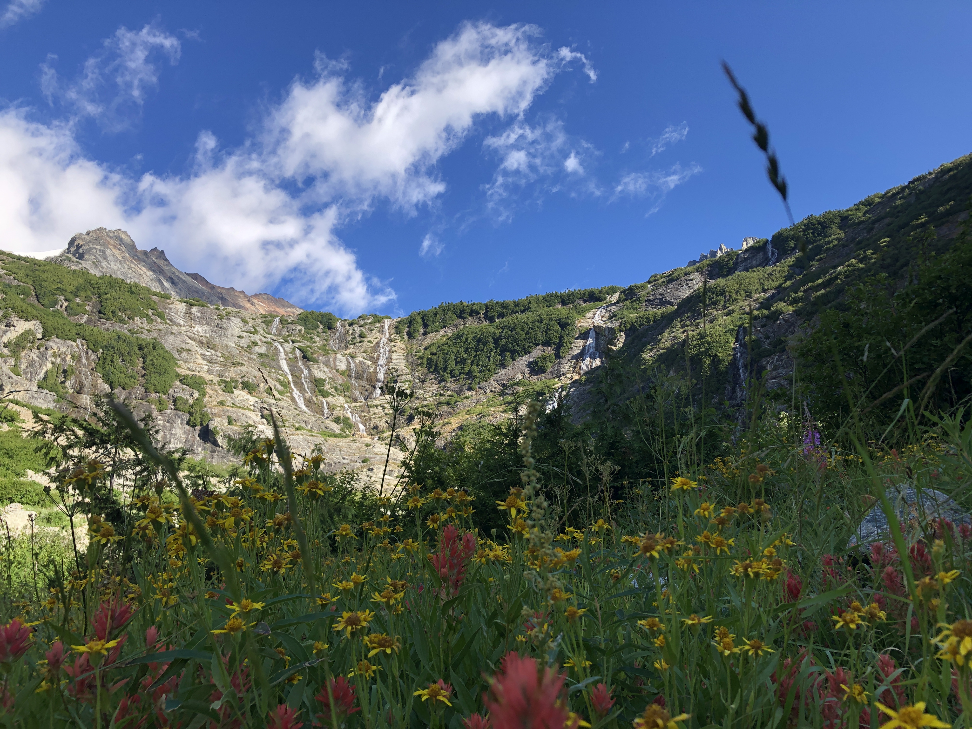
Day 4: From Basin Creek, it is a short 2 mile hike, with a 1500 feet elevation gain to Horseshoe Basin. This is a spectacular area to enjoy meadows with wildflower and a panaromic view of the massive cirque with numerous waterfalls tumbling down the cirque. After enjoying this scenery, we headed back to camp, packed up and headed back to our car.
At Horseshoe basin, there are rusty old cables that provide a reminder of the mining activity several decades ago. There is also a mine which can be visited, if you can clamber the steep talus. Going up this path seemed easy, but coming down was a nightmare since it was easy to cause and be part of a rock slide.
Distance: 11.5 miles, +3700 feet, -3200 feet
Practical considerations:
If you want to plan a similar trip, here are some additional tips and details that maybe helpful to you. Also, the entire GPS track is available if you want it.
Planning:
The most important part for planning this trip is to get a permit. The permits site has instructions on how to get the permits. Essentially there are 2 ways:
- Advanced reservation, where you apply for a permit between March 15th and April 15th. 60% of the reservations are offered for advance reservation
- First come first served, where you show up at the ranger station the day of or the day before your trip and see if you can snatch a permit. The Marblemount wilderness information center was the only one open in 2020 due to COVID. It opens at 7am. Normally, people are required to queue up and the earliest people generally show up is around 6. However, in 2020, there is a ticket dispenser kept outside when the ranger station closes at 4pm. Once you get a ticket, you are required to show up at 7am when the ranger calls the numbers. We didn’t know this, and when we came at 6am, there were already 15 people ahead of us!
Besides Sahale Arm and Basin Creek, North Cascades offers several other backcountry options. This PDF is a great resource, that shows a map of all the campsites.
Backcountry campsite availability shows what sites are available, so you can fine tune your plans just before you head to the ranger station. We couldn’t check this once we reached the ranger station, since there is no signal to connect over phone.
Every camping area has a vault toilet. It was very impressive to see cleanliness maintained by the park system, and also by all the people who use them.
Mountain goats, marmots and black bears are the primary wildlife in this area, but they pretty much leave you alone. You are required to handle your food carefully to avoid bears getting attracted to the campsites. For Sahale Glacier, we had to carry a bear canister which was loaned to us at the ranger station. In the Stehekin valley, campsites have a bear box where you can deposit your food. At Basic Creek there was a cooking area where we had the pleasure of meeting other campers and sharing our stories.
Many people just go up to Cascade pass for a day hike and it is great hike, 7.4 miles roundtrip with 1700 feet elevation gain and loss. Some people even go to Sahale for a day hike, and while spectacular, it is a gruelling 13 mile hike with 4200 elevation gain and loss over steep terrain.
