A short trek in the French and Spanish Pyrenees
A backpacking journey into the Pyrenees mountains, going over from France to Spain, and then back from Spain to France
The Pyrenees is a spectacular mountain range that forms the border between France and Spain, going from Atlantic Ocean on the east to the Mediterranean sea in the west. Two mountain trails, GR10 in France and GR11 in Spain, run the length of the Pyrenees mountain range, about 900 kilometers long. Most people spend 45 to 60 days on either one of these trails, walking from one end to the other, using the refuges (mountain huts) on the way for food and shelter.
We had two weeks, and we picked the parts that most appealed to us. The first week we focused on the mountains in the central part of the Pyrenees. We started with GR10 at Pont Espagne and walked east to Gavernie. From there, after a quick detour to Pic Du Midi, we headed south into Spain over Breche de Roland to GR11 and into the Ordessa canyon. The second week was spent on the coastal trail along the Mediterranean sea, walking from Spain to France. These were two blissful weeks filled with stunning scenery, tasty food and delectable wines.
This trip was completed in August 2018.
Part I: France to Spain
Here’s a map that gives a view into what we did: it also allows you to download the GPS tracks for the treks we did.
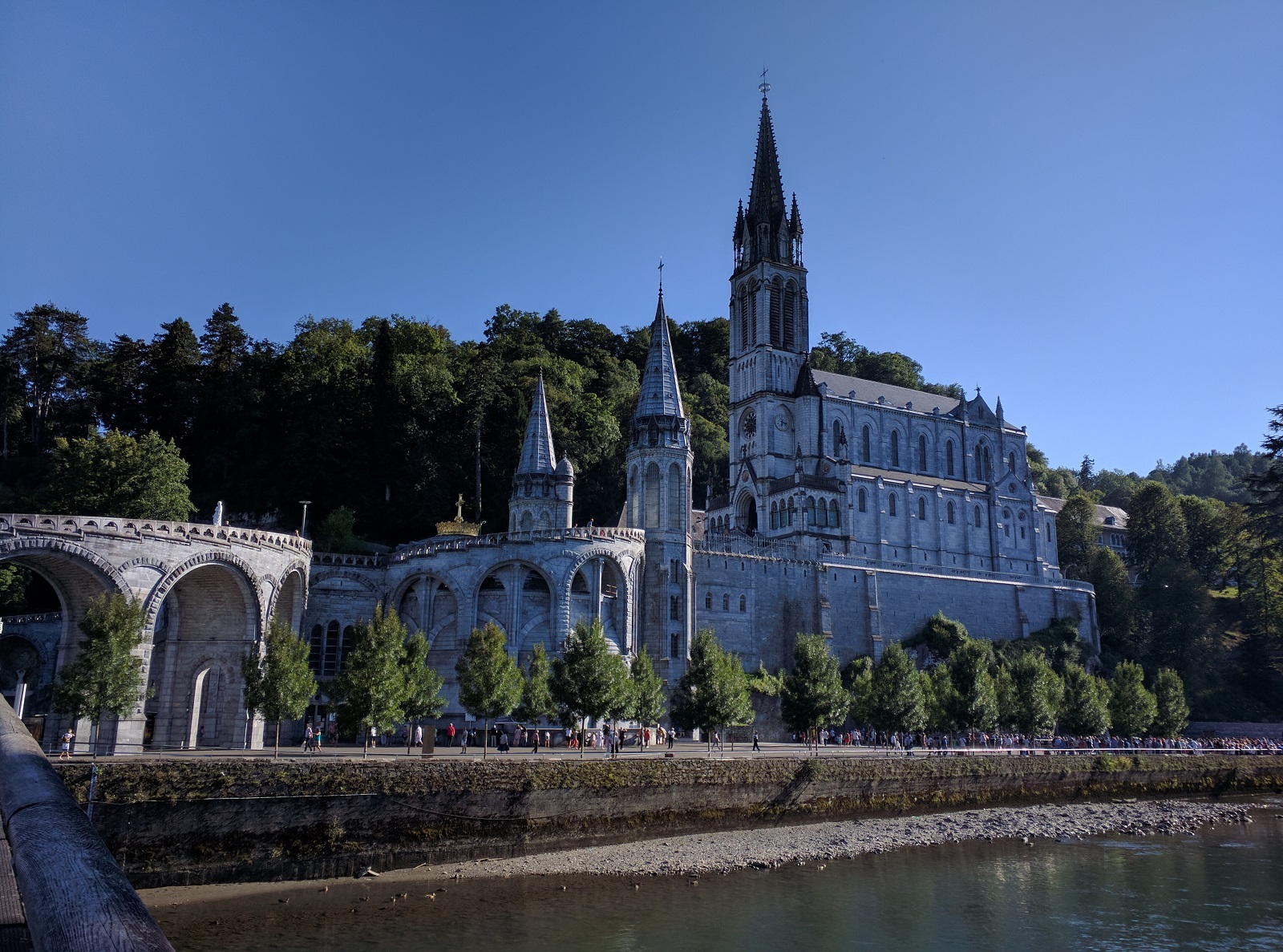
We flew into Pau, the Pyrenees airport and stayed at Grand Hotel Moderne in Lourdes. Across the hotel was Cathedral of the Lady of Lourdes and we took part in the lantern festival that went late into the night.
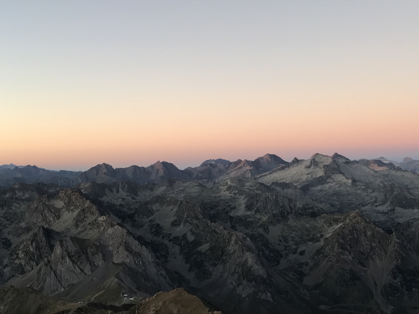
The next morning, our hotel arranged a taxi to take us to Pont Espagne (elevation: 5000ft), the starting point of our hike on GR10 from where we hiked 8 miles (12 KM) to Refuge Beysellance (elevation: 8508 feet). A big part of the day involved walking by the magnificent Mount Vignemale, the highest summit of the French Pyrenees. The landscape we passed was simply stunning.
The weather was clear all morning, but as we approached our peak elevation of 9000 feet, we noticed the clouds rolling in behind us and within minutes the path behind us was hidden in a white-out.
It was simply magical to sit at the pass, watching the beautiful mountain range. In a distance we sighted our destination, Refuge Beysellance!
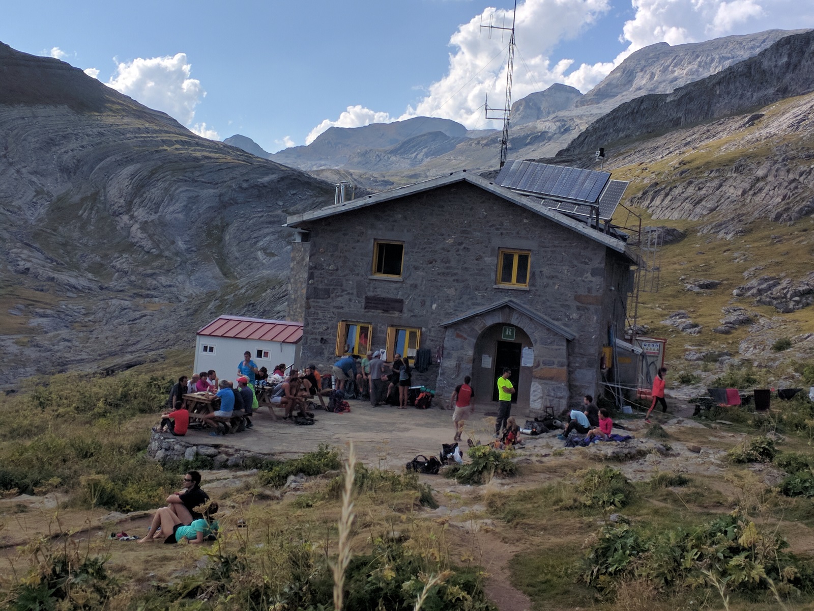
Like all mountain huts (refuges) on the trail, Refuge Beysellance offers half-board, serving dinner and breakfast, and the option to buy a picnic lunch.
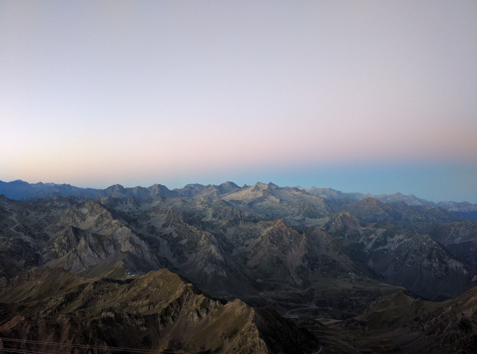
The next day, we headed back on the trail. The views continued forever. In a distance, we could see the Breach of Roland, a gap in the mountains far far away that we will be crossing a few days later. We headed down most of the way, for 11 miles, to the town of Gavarnie (elevation: 4884 feet).
The next day, we hiked for an hour to the Cirque of Gavarnie, this is a sight not to be missed! The massive granite walls rise up to almost 5000 ft, and it is a collosal panoramic sight, thousands of feet wide. This was a great place to just sit, watch and meditate on the immense beauty.
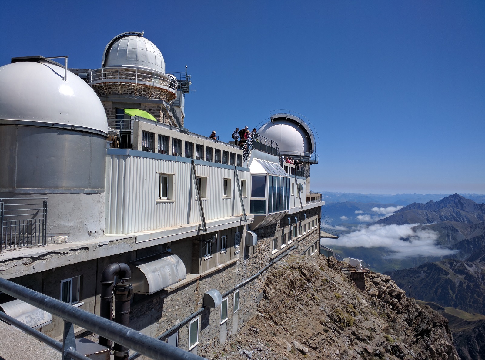
After lunch, we took a taxi to the cable car station at Pic Du Midi, about 40 kilometers from Gavarnie. The cable car took us all the way to the summit of Pic Du Midi (elevation: 9439 ft.) There is a hotel and an observatory on the peak and our room had direct views to the sea of mountains that made up the Pyrenees! They room rate included a wonderful dinner, and also star gazing in the observatory.
We had heard stories on tripadvisor that everything is in French, and many people didn’t have a great experience. We knew about that in advance and still opted to go, and we were pleasantly surprised. Everyone went out of their way to accommodate us, and the main staff member who was speaking kept making sure we had a great experience!
The next morning after breakfast, we headed down the mountain and met our pre-arranged taxi to take us to Gedre where we spent the night. We also hiked to Cirque de Troumouse, but it paled in comparison to Cirque de Gavarnie.
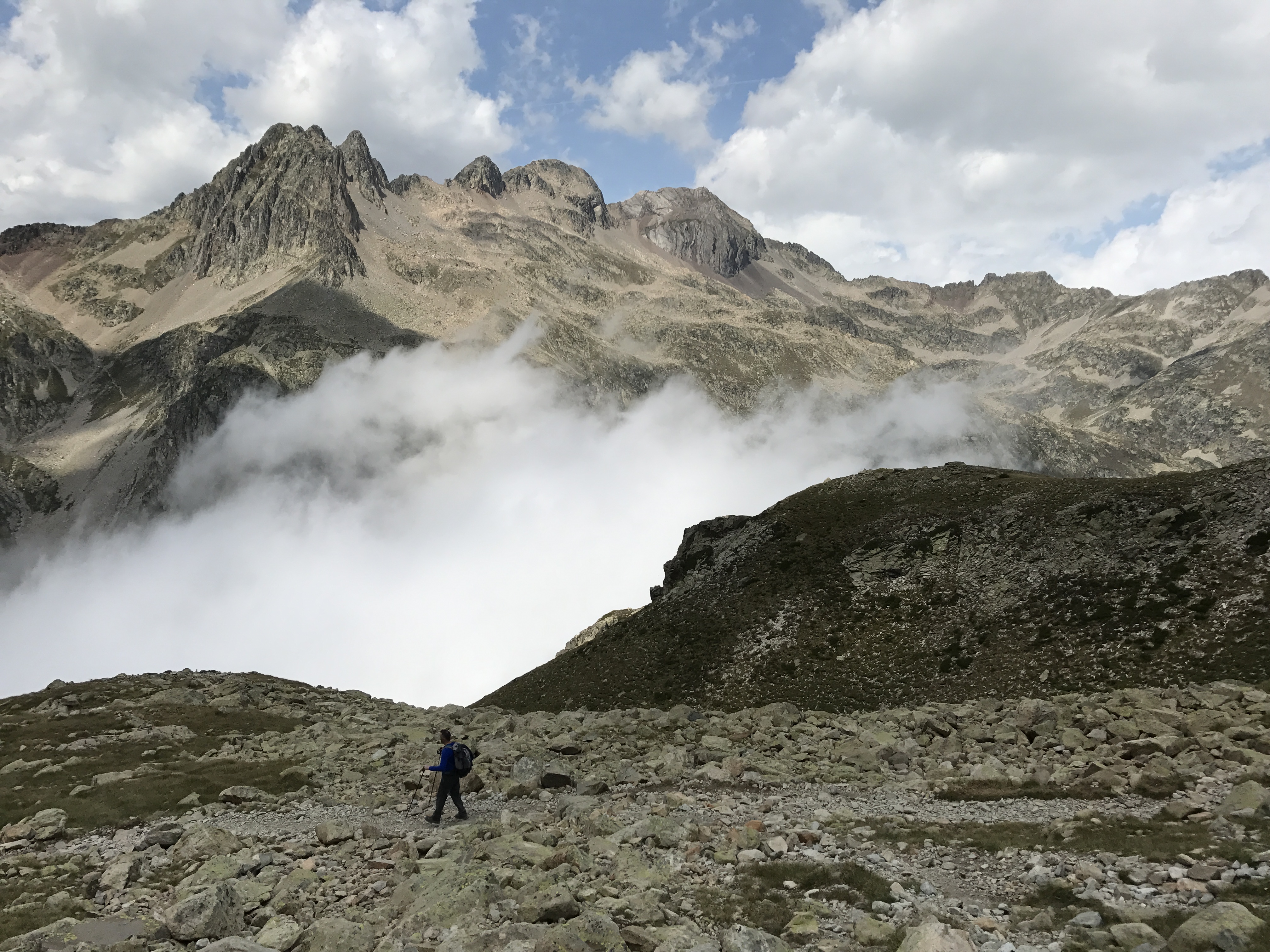
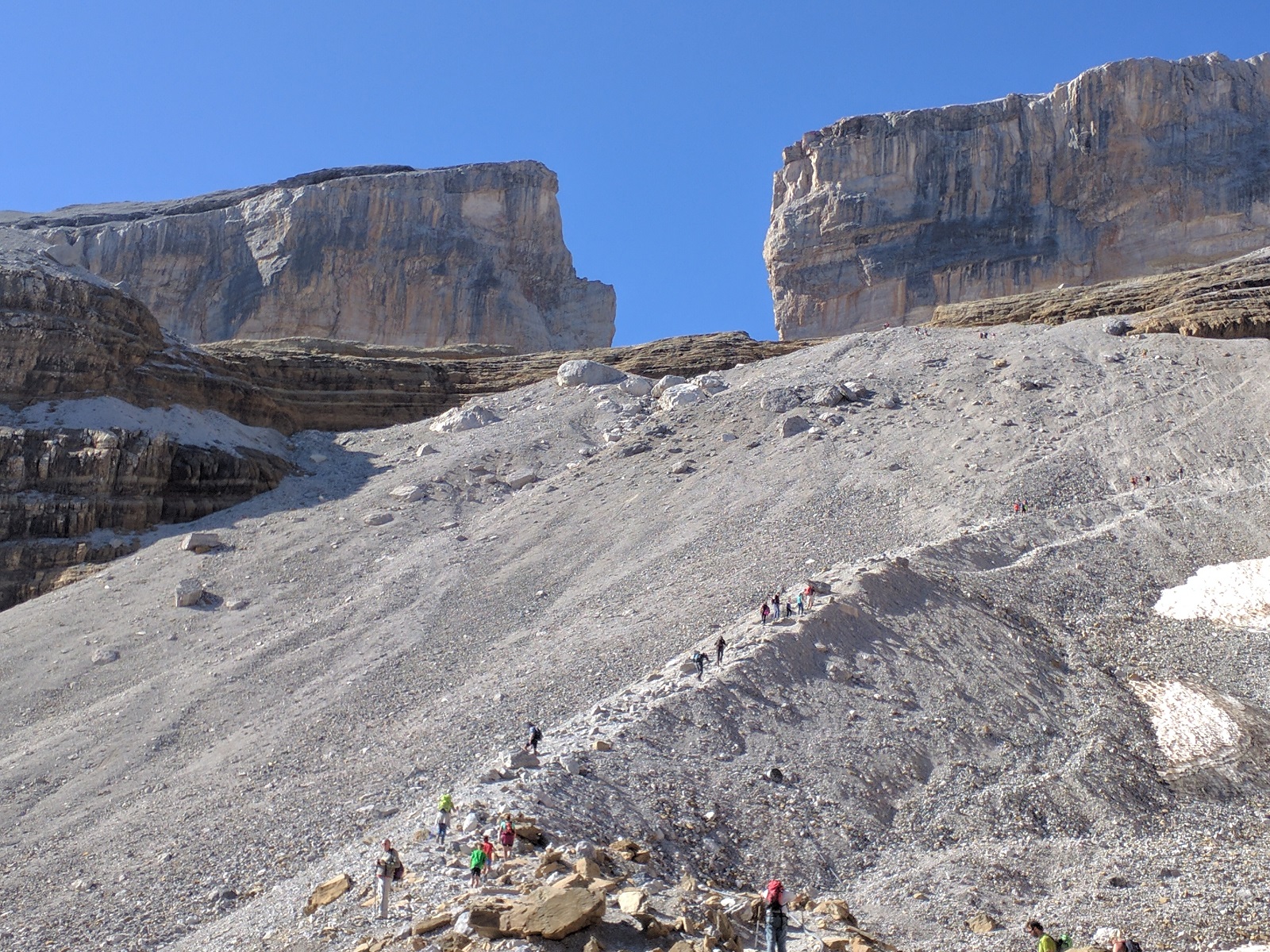
The following morning, our taxi picked us up early to take us back to Gavarnie, to Col de Tentes (elevation: 7200 ft), from where we hiked over the mountain range into Spain. It was a challenging hike up to Breche de Roland (elevation: 9100 ft), and it was simply spectacular to stand at the top of the world bordering France and Spain.
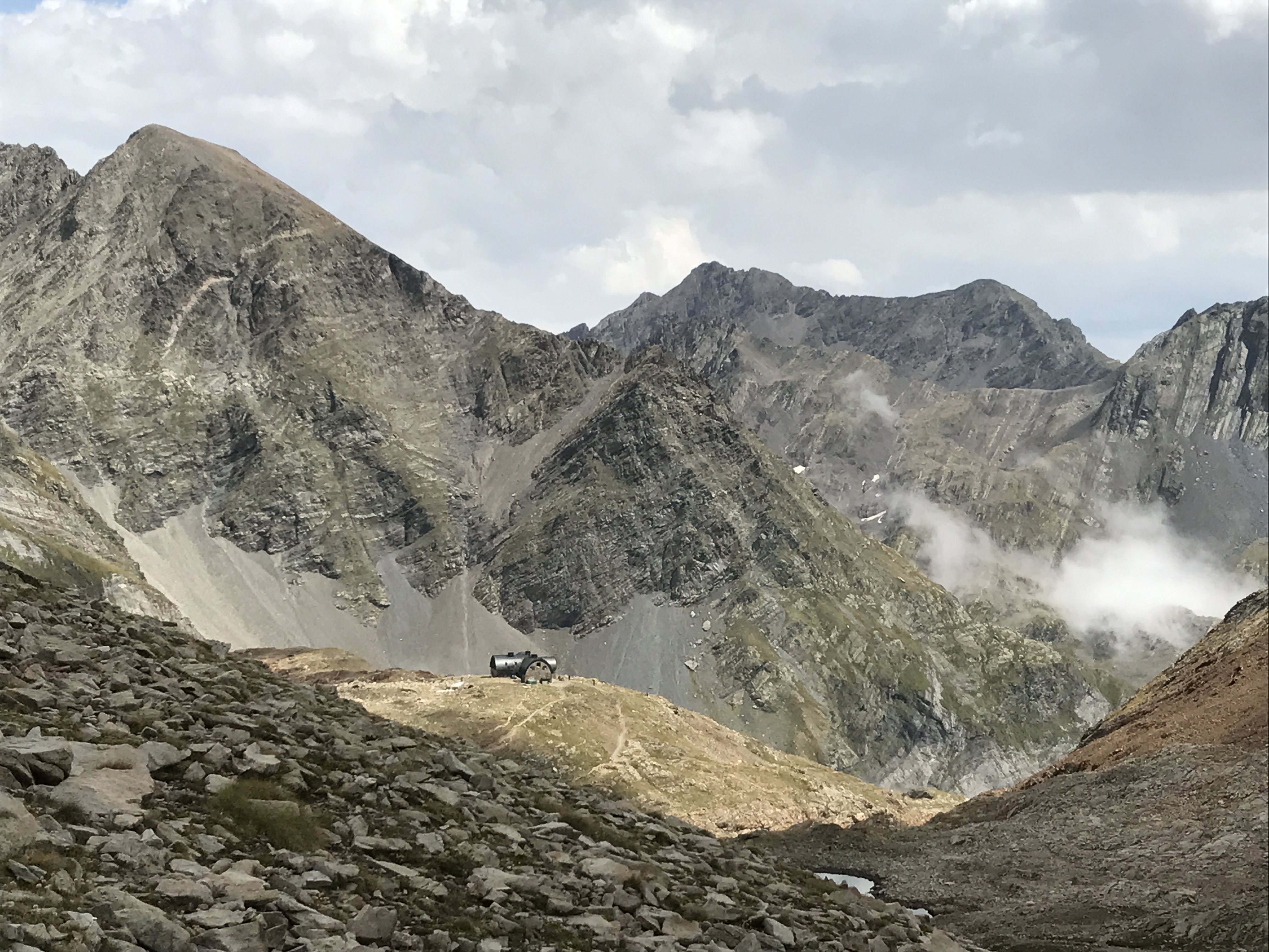
Once we crossed into Spain, we saw a bewildering array of options taking us left, right or center and it was hard to figure out which option will take us to our destination, Refuge Goriz. In a distance, we saw a group of hikers lodged precariously on a mountain ledge and we knew that route was not for us. After talking to a few folks on the gap, we figured our best option was to stick to the center even though there was not a well marked trail. And after some trial and error, we landed on GR11 towards Goriz.
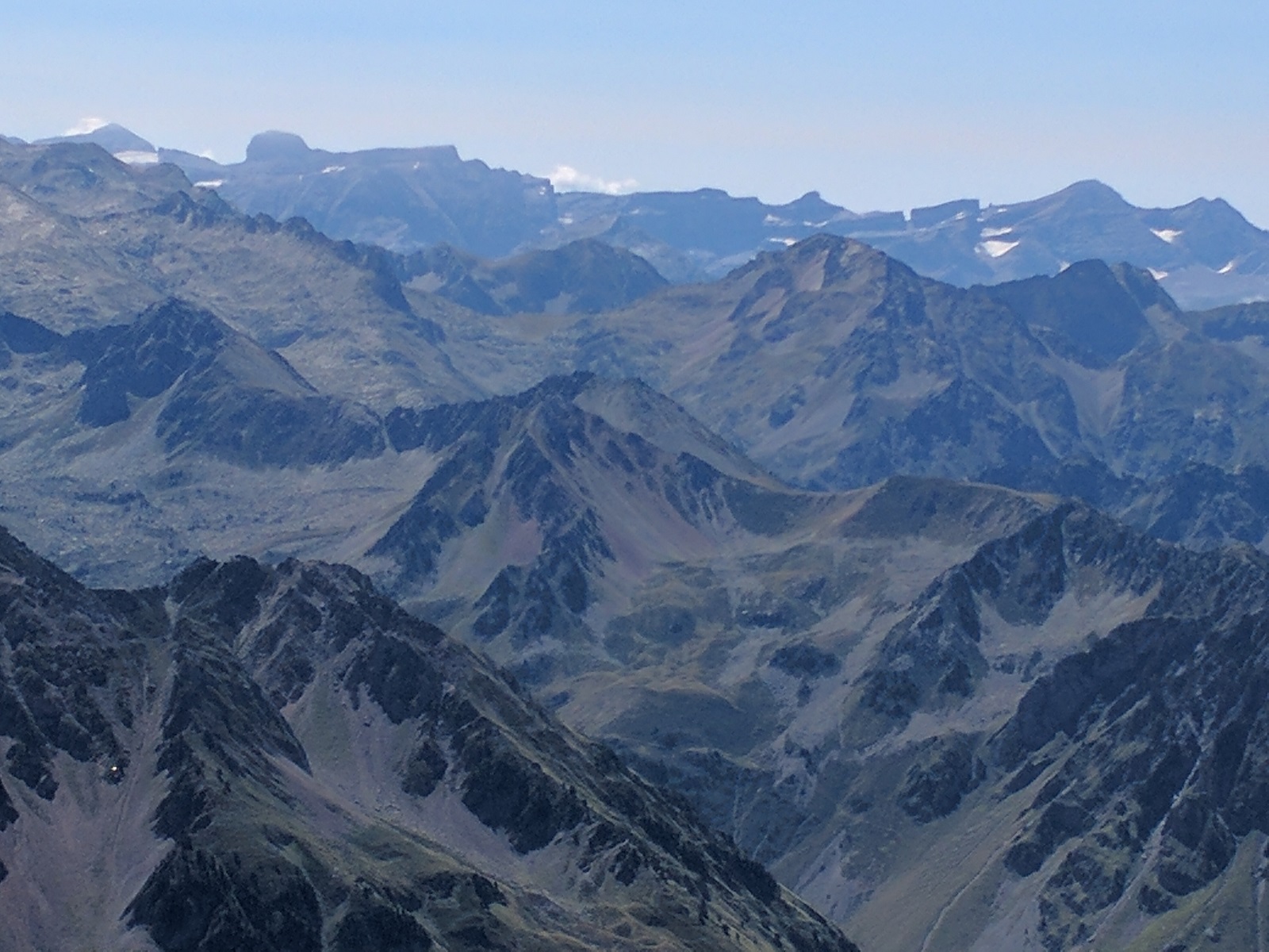
The next day, we headed off to Ordesa Canyon. There were several paths we could take, and we opted for Faja del Pelay which is the high elevation route from which we looked down into the canyon. If we had to do this again, we probably would have hiked down in the canyon.
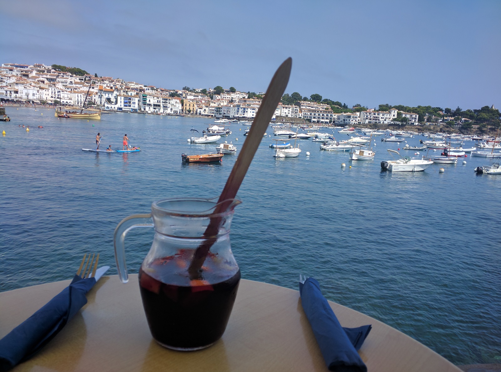
Once we reached down towards the park’s parking lot, we got a shuttle bus to take us to the Torla which is the town a short distance away. From here we took bus connections to take us to Barcelona, and from there headed by train to Figures, reaching there late in the night. The town was still festive and we had dinner over a delectable bottle of wine. We were now ready for our second part of our trip, walking back to France from Spain along the Mediterranean coast.
Part II: Spain to France
This is the map for our second part of the trip…
Figures is home to Salvador Dali, and it was a pleasure to spend a couple of hours at the Dali museum before we headed off to the peninsula in the east, Cap De Creus to our starting point: Cadaques. This is a beautiful sea town with plenty of walking trails and a lot of food choices.
The Mediterranean coast is beautiful, but extremely humid and we were sweating profusely as we walked.
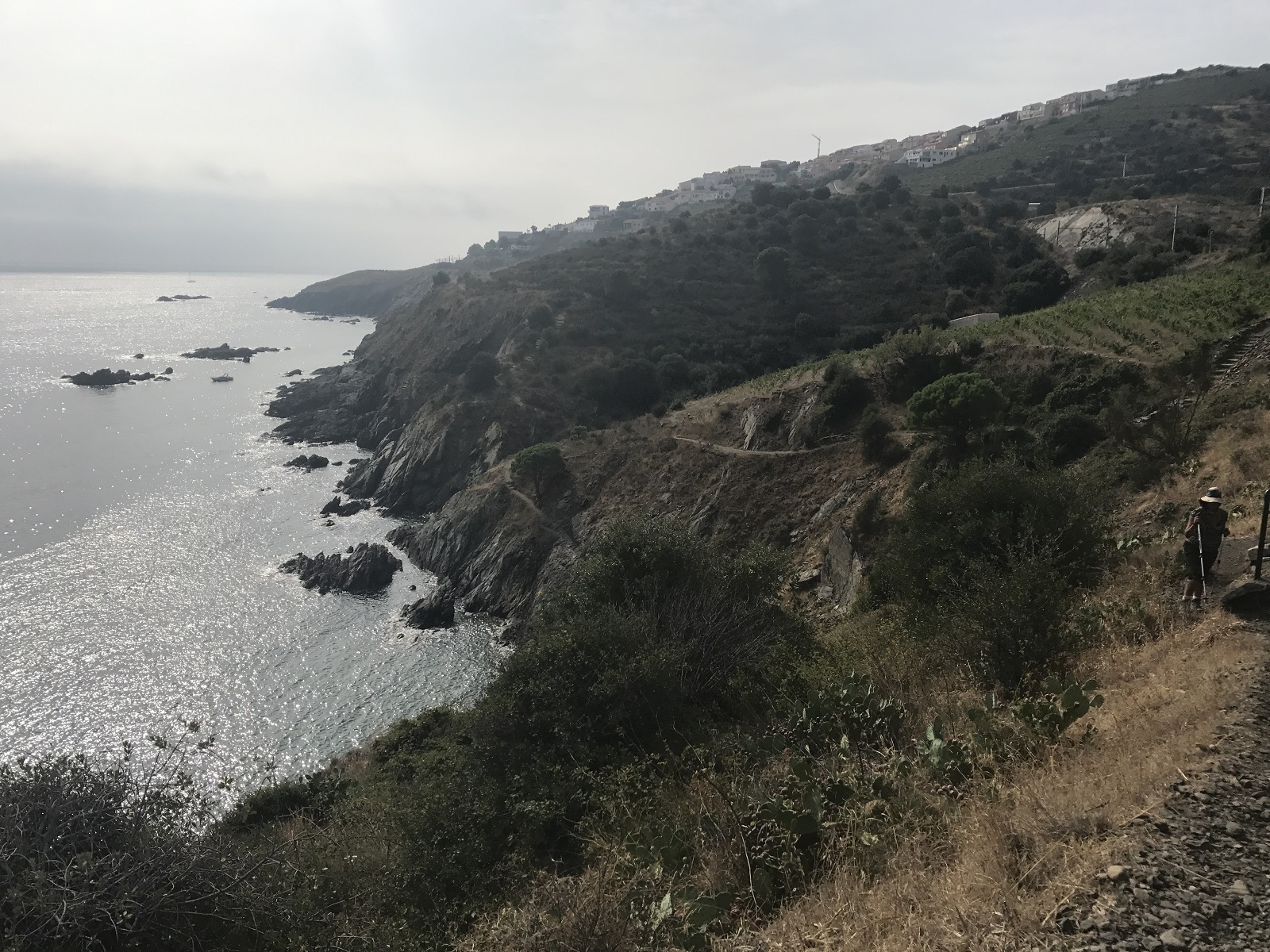
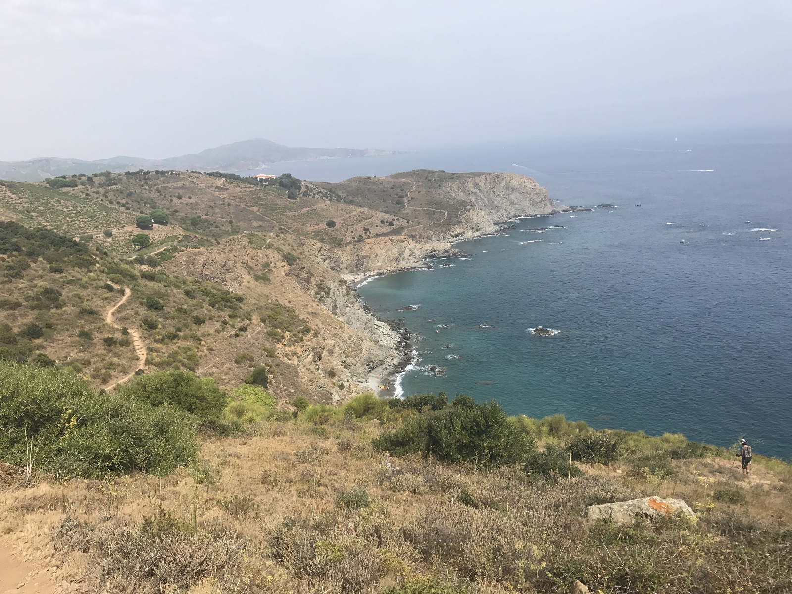
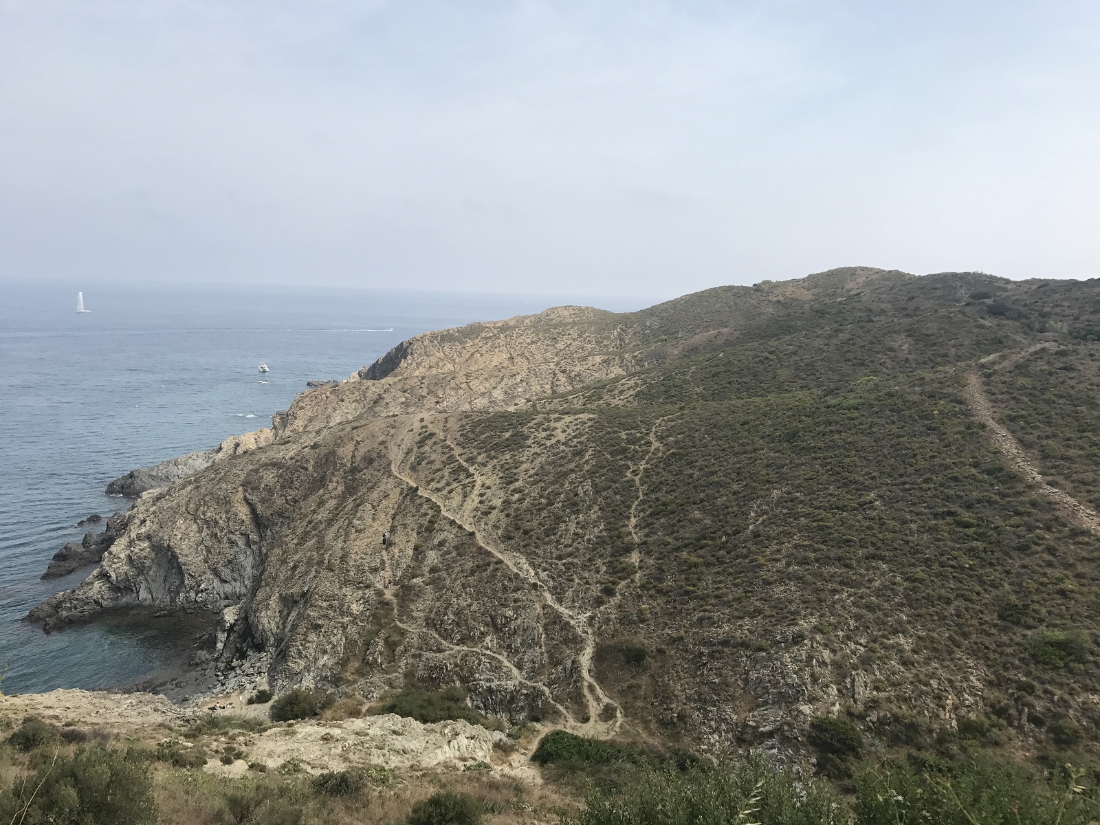
Our plan was to walk from Cadaques in Spain to Collioure in France, a total distance of roughly 70 kms over 4 days. The first day we took a leisurely stroll to Cap De Creus, where GR11 terminates in Spain, and we returned to our hotel in Cadaques. The next day we headed off to Llanca, a part of this route was along GR11. The views and the food continued to impress us.
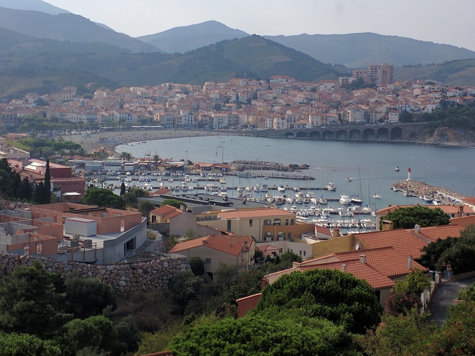
From Llanca we made our way to Cerbere where we stopped for the night. The next day we walked over into France, and headed to Banyuls, which is the terminating point of GR10. Le Fanal is Michelin star restaurant in Banyuls that made for a great dining experience!
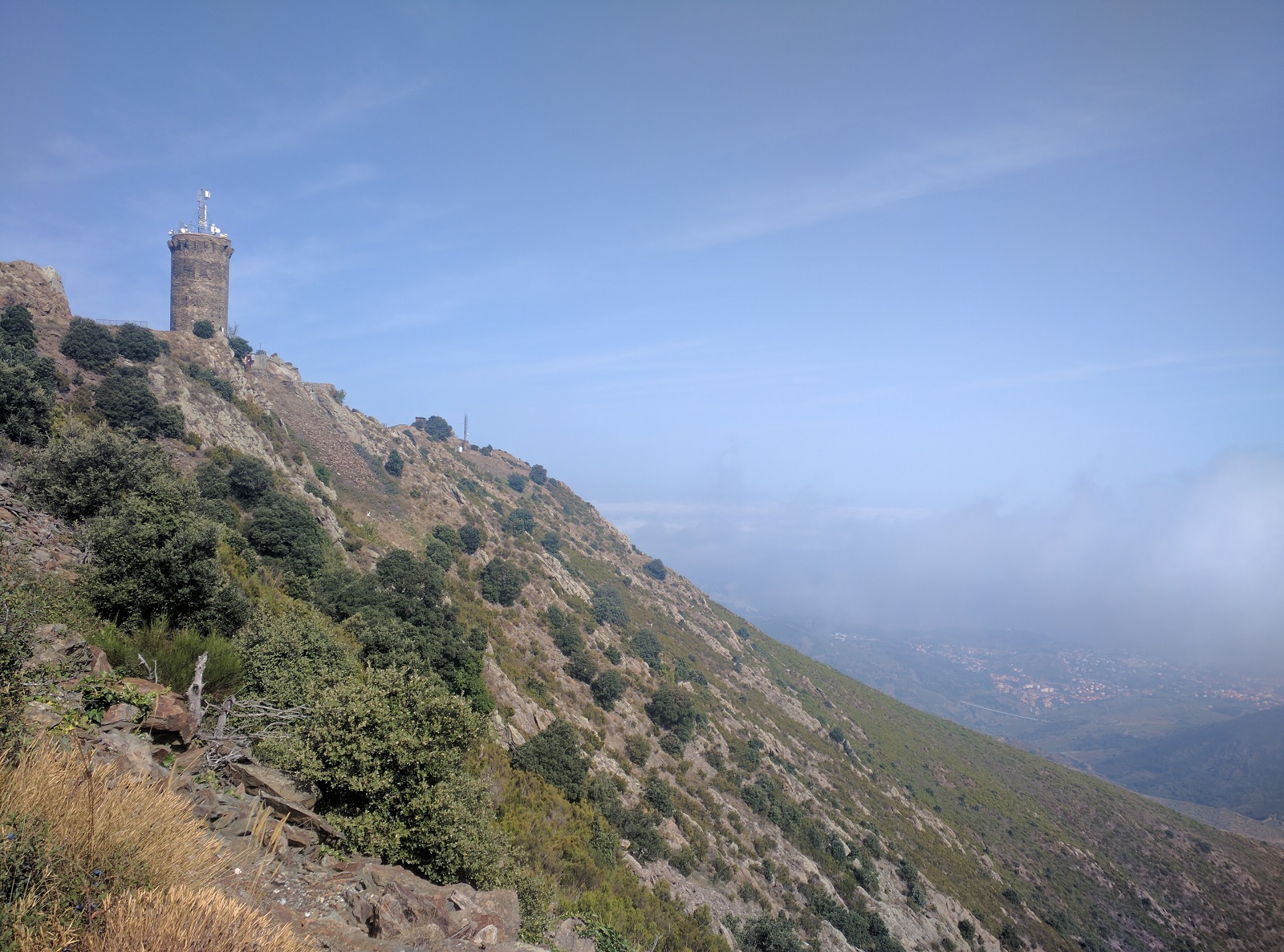
The next day we left the coastal hike, and instead opted for the cooler mountainous hike to Collioure. We hiked to Madeloc Tower, which offered us a broad view of the coast but the clouds had rolled in and we made the best of what was offered to us.
At Collioure, our hotel Relais des Trois Mas, is home to another Michelin star restaurant, the La Balette and we had a time of our lives at the hotel and the restaurant.
The food was sooo good, and we got too busy eating to take any pictures. After exploring the town the next day, the hotel arranged a taxi to take us to the airport at Perpignon from where we headed back home.
This was an awesome trip that mixed the mountains, the oceans, food and wonderful people. We highly recommend it!
Practical considerations:
If you want to plan a similar trip, here are some additional tips and details that maybe helpful to you. Also, the entire GPS track is available if you want it, by going to the map at the beginning of Part 1 and Part 2: simply click on the top right hand corner to open larger map, and then use the download KML option.
Our itinerary was centered around Gavarnie, a night at Pic Du Midi, the cut in the mountains (Roland’s breach) and the Mediterranean coast. With these things in mind, and 2 weeks to do all of it, we came up with this plan:
-
Day 1. Fly into Pau from Paris. Then take a bus/train/taxi to Lourdes. Being jet lagged, we opted to just take a taxi from Pau to Lourdes, which cost us around 100 Euros. We stayed at Grand Hotel Moderne in Lourdes, and highly recommend it for both the comfort and location.<
-
Day 2: We planned to get on the GR10 trail at Pont d’Espagne, which is close to Lourdes. From Pont d’Espagne, we would walk 13km (8 miles) with an elevation gain of 1200m (4000 ft) to our mountain hut, Refuge Baysellance. We took a taxi to Pont d’Espagne for an early start. Optionally we could have caught a bus to Cauterets and walk an extra 8km between Cauterets and Pont d’Espagne. The trails are well maintained and well marked. Along the trail, you will see rocks painted with two parallel lines, one red and the other white, to indicate you are on GR10. There are also signs periodically pointing to you the way forward. Refuge Baysellance is a very basic mountain hut, no showers and the squat style toilets. But at 9000 feet in the mountain, it was a luxury to sip some wine and eat the communal dinner of soup and meat. The refuge has roughly 60 beds in 6 rooms. We got lucky to get a room with just 3 beds.
-
Day 3: Head to Gavarnie, hiking 18 km (11 miles) downhill losing an elevation of 1200m (4000 ft) and stay at Hotel Des Cimes right in the center of town and close to everything. From there we planned a quick detour to stay at the top of Pic Du Midi, and then Gedre to hike Cirque Troumouse. This part turned out very challenging due to transportation: the best option was to hire a taxi, but there is one taxi in all of Gavarnie and one taxi in the neighboring town of Luz Saint Sauveur. Both taxis were fully booked, but we managed to work with the taxi drive in Gavarnie to accommodate us.
-
Day 4: Hike to Cirque de Gavarnie, 9km (5.5 miles) round trip with elevation gain and loss of 1000 ft. The trails start right from the town and the views are simply spectacular. Then head to Pic Du Midi for our night under the stars.
-
Day 5: Stay in Gedre and take a taxi to the village of Heas to the starting point of our hike to Cirque De Troumouse 7k (4.6 miles) (GPS track) with elevation gain of 2000 ft. Have our taxi pick us up at our end point at a predetermined time, to take us back to our Gedre hotel.
-
Day 6: Taxi from Gedre to Col De Tentes, to start our hike from Gavarnie in France to Refuge Goriz in Spain, walking over the mountain range through a gap in the mountain called Breche de Roland. Distance 20km (12miles) (GPS track) Roughly 20km/12 miles, starting at 7200ft, reaching a peak of 10300 and ending the day at 7500 ft: 3000 ft elevation gain and loss. Refuge Goriz is very popular, there were a lot more people there than in Refuge Beysellance, and there were numerous tents setup around the refuge. We also had to change our travel dates by a day or two, since our original date for Refuge Goriz was fully booked, 6 months in advance!
-
Day 7: Walk from Refuge Goriz through the Oredesa Canyon, and make our way to Torla. Roughly 20km/12 miles, downhill all the way from 7500ft to 3500ft, elevation loss of 4000ft. From Torla, there are transportation options to take us to our final destination for the day, Figueres. We would make our way to Barcelona first, which required us to make a bus connection on the way. From Barcelona, we would catch a train to Figueres
-
Day 8: Spend the day in Cadaques, the start of our walk back to France. Since this walk took us through several towns, we planned to stay in hotels and also decided to send our backpacks by taxi to our next destination. This turned out to be a wise move, since this part of the trek was very hot and humid and we would have been miserable with the packs while walking.Walk from Cadaques to Cap De Creus and return, 16km/10 miles round trip, mostly flat.
-
Day 9: Cadaques to Llanca, 22km/13.8 miles, 1000 ft elevation gain and loss.
- Day 10: :Llanca to Cerbere, 14km/8.8 miles mostly flat
- Day 11: Cerbere to Banyuls, 10km/6.3 miles mostly flat.
- Day 12: Banyuls to Collioure, 15km/9.5 miles, 2000 ft elevation gain and loss.
- Day 13: Taxi to Perpignon, and fly back home via Paris.
